- Author
- Australia Post
- Subjects
- History - pre-Federation
- Tags
-
- RAN Ships
- None noted.
- Publication
- September 2002 edition of the Naval Historical Review (all rights reserved)
Amid the rivalry of the French Revolutionary and Napoleonic Wars (1792-1815), France and Britain sponsored voyages of discovery to complete the charting of the Australian coastline and further scientific knowledge of the region. Led by naval captains Nicolas Baudin and Matthew Flinders, both expeditions carried safe-conducts protecting them from seizure by ships of the opposing navies as the two countries were at war. Between 1801 and 1803 Baudin and Flinders filled in most of the gaps on the coastal charts of what was then termed New Holland.
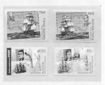
The two explorers paths crossed on 8th April 1802 near the South Australian coast. Flinders, boarded Baudin’s ship, the Geographe. The two commanders exchanged information about their discoveries. Flinders named their meeting place Encounter Bay. Although this encounter ended Flinders’s hopes of being the first to chart the entire southern coast of the continent, he was able to claim that Baudin’s “Terre Napoleon” was limited to just 50 leagues of coastline.
The expedition under NICOLAS BAUDIN (1754-1803) left France on 19 Oct 1800. Cape Leeuwin was sighted on 27 May 1801 and the west coast as far north as the Bonaparte Archipelago was charted before sailing on to Timor. On 13 Nov 1801 Baudin left Timor, sailing back down the west coast and across to Van Dieman’s Land, surveying around the D’Entrecasteaux Channel, Tasman Peninsula and Maria Island before heading across Bass Strait. After his meeting with Flinders, Baudin was forced to break off his survey and make for Sydney for provisions and medical help. One of the expedition’s most important achievements was the pictorial record it provided of the indigenous people of Tasmania and drawings and paintings of flora and fauna.
CAPTAIN MATTHEW FLINDERS, RN (1774-1814), in command of HM Sloop Investigator, sighted Cape Leeuwin on 6 Dec 1801. He then charted the southern coast, naming Port Phillip Bay and sailed north to Port Jackson (Sydney). On 22 July 1802 he set sail once again, surveying the Queensland coast and continuing on through Torres Strait and into the Gulf of Carpentaria. Investigator was not sufficiently seaworthy to allow the surveys to continue. Flinders nevertheless returned to Port Jackson via the west coast, thus completing the first circumnavigation of the continent. His charts of much of Australia’s coastline were so accurate (like James Cook’s) that they have remained in use for nearly two centuries.
(Courtesy of Australia Post’s Commemorative Joint Issue of postage stamps with France earlier this year)
